
Considering that Prepar3d is being actively developed and improved. I thought it would be useful to point out some of the scenery errors which have been inherited from ESP. If you know of any which aren’t listed below, please submit them so I can generate a comprehensive list.
Greenland:
There is an elevation error in Greenland which causes huge spikes to rise out of the ground. Additionally, in the centre of these spikes is an area of ground over 100,000 ft below sea level.
Near KEVW:
Close to this airport is a spike similar to the previous one, however this one is only around 16,000 ft high with no hole associated with it.
ENDI:
This airport is surrounded by large, steep cliffs, apparent elevation errors.
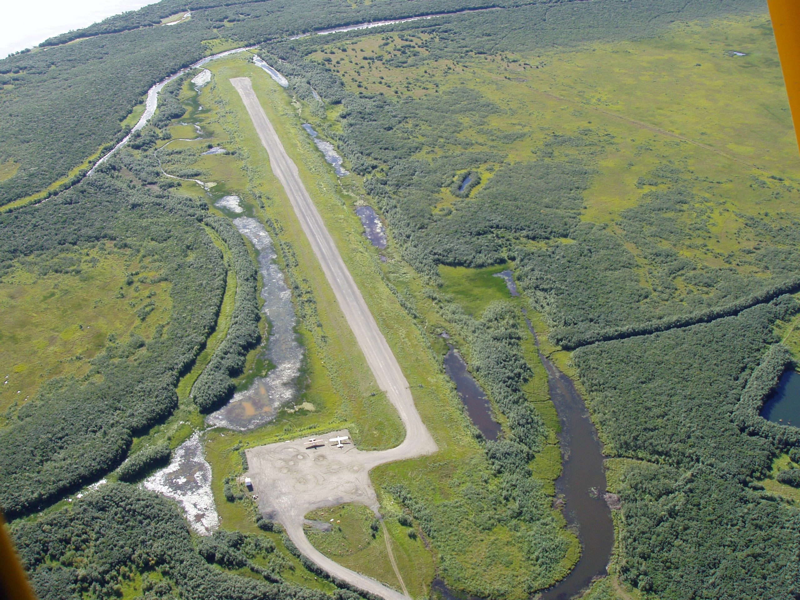
SVAS:
Similar to ENDI, this airport is in a large hole in the ground.
FBKE:
Similarly to the previous two, this airport appears to be located in a large crater, which it isn’t in reality (source: http://www.youtube.com/watch?v=67uES6mzy4I)
9AK8:
The runway for this airport is a few thousand feet below the surface of the ground. This screenshot shows a viewpoint looking up at the ground from underneath.
CBZ3:
The runway at this airport seems to have split into three sections. Additionally, there is a building on the runway.
EGUW:
In the very middle of the runway there is an ATC tower.
MCBZ:
This airport has trees covering the runway.
NRQ:
As you can see from the image, this airport has a very unusual runway layout. When you look at this airport in Google maps it turns out to be a series of helipads linked by taxiways, NOT 8 runways as depicted by Prepar3d. To see this airport in google maps paste “30.625468,-87.139907” into the search box.
S28:
Elevation errors producing large hole in ground.
SVAS:
Elevation error has caused this airport to be in a large hole. The elevation is relatively flat in reality as evidenced by this photograph: http://www.dot.state.ak.us/stwdav/image ... uk2007.JPG
WAJJ:
The lake at this airport is too high. The result of this is that the ILS approach for the runway will cause you to fly into the lake itself. The first image shows how steep the approach has to be to avoid the lake, and the second shot shows the glideslope when I am in this position.
WN23:
This airport doesn’t have anything graphically wrong with it. However, it is a single grass runway yet is listed as an international airport. Image below:
YXFV:
This airport has a very short runway. Additionally, the runway markings are in the centre of the runway and overlap each other. Further to this, there is a tower on the runway. If you search “newcastle westpac base heliport” on Google maps you will find that the airport is infact a heliport with no runway.
As I said at the beginning if the post, I would be extremely grateful if others could post any scenery issues they have discovered with Prepar3d so that the developers can be made aware of them.
Compilation of Scenery Errors

I've discovered a few more issues to add to this list, which are featured below:
Tanzania:
This is a very strange occurrence. There is a very large (several KM long) “V” shaped valley in Tanzania. At the bottom of this valley there is a strip which resembles some sort of dirt runway or road. My screenshots can explain it better than I can in words so please see below. (co-ordinates are included in the screenshots)
FV76:
This airport has an issue with being inside a large crater like many of the other airports i’ve mentioned. However, this airport is unusual in that the runway is at the correct height still, meaning that it is floating in the air, as can be seen in the screenshot.
FAHS:
This airport has two runways. One of them is fine. However the other one is floating above a large hole, see screenshot.
KMAE:
This airport has a terminal building in the middle of one of the runways.
-
Legacy Support
- Posts: 474
- Joined: Mon Aug 16, 2010 7:22 pm
Note that WN23 is actually an international airport, if in name only.
WN23 Grand View International Airport
http://airnav.com/airport/WN23
WN23 Grand View International Airport
http://airnav.com/airport/WN23
Alex Goff
Orbx Simulation Systems
Orbx Simulation Systems
Yes, I am not going to change the name of WN23  . I've noticed a handful of very small "international airports" in the database.
Also note that NRQ is actually 8 runways, (I lined these up for FSX, look for this airport in FS2004 to see the difference) but in reality they have been painted over to look more like the helipads you see in satellite / aerial imagery. I'm leaving this for a talented add-on dev to take on. The inner artist in me must resist and move on. I'll post some more updates soon.
Also note that NRQ is actually 8 runways, (I lined these up for FSX, look for this airport in FS2004 to see the difference) but in reality they have been painted over to look more like the helipads you see in satellite / aerial imagery. I'm leaving this for a talented add-on dev to take on. The inner artist in me must resist